Application cases of police drones in the public security field Leave a comment
The application of man-machines in urban management and agriculture is commonplace, and you can use drone tilt photography for 3D real-world modeling, but police drones may be relatively unfamiliar to everyone, and use drones to solve crimes in the mountains. It is difficult for us ordinary people to come into contact with this kind of thing. Recently, the Yichang Public Security Bureau used drones to help poor households find 30 lost animals. Today, the editor of FlyDragon aviation used this case to tell everyone about the police use. The application of man-machine in the field of public security.
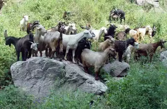
Can drones solve crimes? Just a few days ago, the Yichang civilian police used drones to help poor households in the jurisdiction to find the 30 missing sheep. After receiving the alarm, the police immediately carried out their work, but no suspicious vehicles and people were found entering or leaving the goat free-range farm. The free-range farming area is a mountain forest with high mountains and dense trees with an altitude of more than 1,600 meters. There are few farmers in the surrounding area. The police analyzed that the goats should not have been stolen. They just ran into the forest. The police led the local villagers into two groups to search for them. A group of people It took three days and only 3 were found, and 27 were still missing. In a dilemma, the police suddenly thought that there were two “drones” in the Forest Public Security Bureau. The policemen brought binoculars and drones into the mountain again to look for sheep. The policemen climbed up to a flat area on a high mountain with an altitude of 1,600 meters, and the drone flew. Some small white dots appeared in the drone’s field of vision after passing the three big mountains. Everyone was excited. It was Zheng’s lost goat. After positioning the police and everyone find it together!
It can be seen that UAVs have been widely used in the public security field of our country. Today, Xiao Fei will sort out the applications of police drones in the public security field.
With the maturity of drone technology, the application fields of drones are becoming more and more extensive. At present, in daily social management work, public security organs provide services to the masses, grasp the actual situation in the jurisdiction, carry out safety precautions, maintain public order, and respond to emergency assistance. , The limitations of traditional measures have become increasingly prominent. How to effectively serve the masses and control the social security situation, and quickly and accurately deal with it is particularly important in the current period.
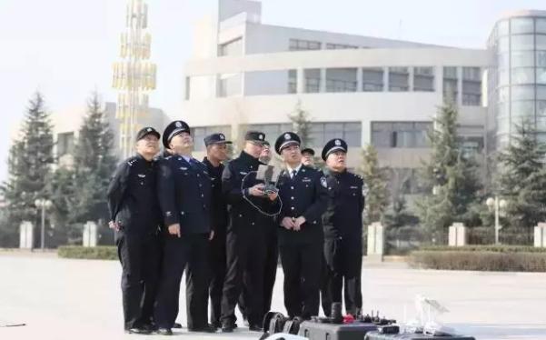
According to the relevant person in charge of the Police Aviation Management Office of the Ministry of Public Security, China’s public security organs are currently equipped with 4,000 unmanned aircraft of various types, and there are more than 2,000 unmanned aircraft pilots. What role can so many drones play in the work of public security?
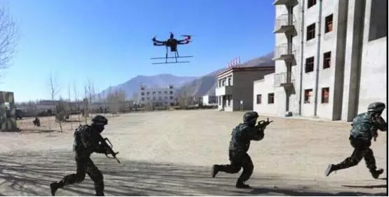
UAV is an unmanned aerial vehicle controlled by radio remote control or program. It consists of an aircraft platform, flight control system, carrying equipment and radio remote control system. It can perform reconnaissance attacks, influence audio acquisition and transmission, item transportation and delivery, on-site intervention, etc. , Also called unmanned aerial vehicle system. Unmanned aerial vehicles are known as aerial robots. With a condescending perspective, they can monitor ground conditions on a large scale, and at the same time, they can quickly reach places that are not easily involved by personnel. They can efficiently perform reconnaissance, monitoring, tracking, monitoring, and inspection tasks, while reducing Personnel risk has important application value in public security business fields such as public security prevention and control, emergency response, anti-terrorism and stability maintenance.
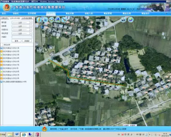
UAVs have the characteristics of fast response, flexible maneuverability, etc., and can provide high-resolution, high-efficiency aerial images. The aerial images collected by the drone are used as the base map of the PGIS platform and the base map of the standard address library to improve the quality of basic data.
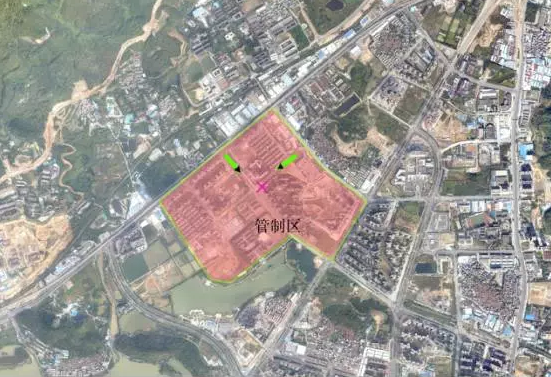
In large-scale arrests, it is often necessary to deploy police forces in the area, which requires environmental resources and basic geospatial data in the relevant area. UAV remote sensing images can provide the public security intelligence system with real-time, objective and detailed terrain, landforms, and buildings. Distribution, road distribution and other information provide geographic information intelligence for the later round up.
Establish a three-dimensional data model library for key anti-terrorism targets, provide various required spatial data for the on-site command and dispatch of emergency response and scientifically assisted decision-making processes, and realize the real-world application of anti-terrorism systems and intelligence systems.