Drones can provide aerial imagery with which to perform precise mapping,complements with survey instruments.
Surveying and Mapping Drones
Showing all 14 results
-
Accessories, Agriculture Drone, Heavy lift Motor/ESC/Propeller, HEAVY PAYLOAD, Industrial Drone & UAV parts, LONG ENDURANCE, Multi rotor drone frame, Security and Police Drone/UAV frame, Security and police drones, Surveying and Mapping Drones
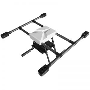
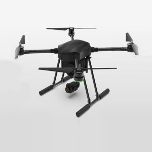
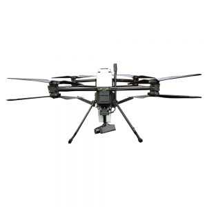
Coaxial Octocopter drone 40 minutes endurance with 2.5KGS payload
 Accessories, Agriculture Drone, Heavy lift Motor/ESC/Propeller, HEAVY PAYLOAD, Industrial Drone & UAV parts, LONG ENDURANCE, Multi rotor drone frame, Security and Police Drone/UAV frame, Security and police drones, Surveying and Mapping Drones
Coaxial Octocopter drone 40 minutes endurance with 2.5KGS payload
SKU: 5487FB8/10-162 -
Agriculture Drone, HEAVY PAYLOAD, Industrial Drone & UAV parts, LONG ENDURANCE, Multi rotor drone frame, Multi rotor drone frame, Security and Police Drone/UAV frame, Security and police drones, Surveying and Mapping Drones
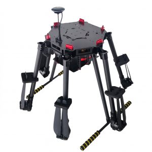
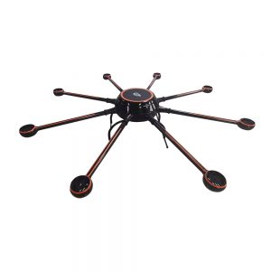
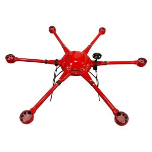
Heavy Lift Drone FD1550 hexacopter for Multi-functional with ranges of max payload to 12KGS Frame KIT
 Agriculture Drone, HEAVY PAYLOAD, Industrial Drone & UAV parts, LONG ENDURANCE, Multi rotor drone frame, Multi rotor drone frame, Security and Police Drone/UAV frame, Security and police drones, Surveying and Mapping Drones
Heavy Lift Drone FD1550 hexacopter for Multi-functional with ranges of max payload to 12KGS Frame KIT
SKU: 5487FB8/10-124 -
Agriculture Drone, Industrial Drone & UAV parts, Multi rotor drone frame, Multi rotor drone frame, Security and Police Drone/UAV frame, Security and police drones, Surveying and Mapping Drones
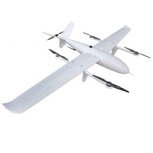
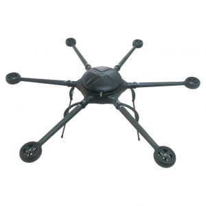
hexacopter Done long flight time long duration large loading capacity for surveillance and inspection & survey and mapping
 Agriculture Drone, Industrial Drone & UAV parts, Multi rotor drone frame, Multi rotor drone frame, Security and Police Drone/UAV frame, Security and police drones, Surveying and Mapping Drones
hexacopter Done long flight time long duration large loading capacity for surveillance and inspection & survey and mapping
SKU: 5487FB8/10-123 -
Accessories, Drone motor, Filming and inspection drones, Industrial Drone & UAV parts, Multi rotor drone frame, Security and Police Drone/UAV Accessories, Security and police drones, Surveying and Mapping Drones
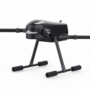
long endurance quadcopter FD465 reach120 minutes and 7 KGS max payload capacity
 Accessories, Drone motor, Filming and inspection drones, Industrial Drone & UAV parts, Multi rotor drone frame, Security and Police Drone/UAV Accessories, Security and police drones, Surveying and Mapping Drones
long endurance quadcopter FD465 reach120 minutes and 7 KGS max payload capacity
SKU: 5487FB8/10-222 -
Accessories, DJI Accessories, Spares and Replacement Parts, Drone motor, Fire Fighting drones, Ground Control Station, Heavy lift Motor/ESC/Propeller, Industrial Drone & UAV parts, LONG ENDURANCE, Multi rotor drone frame, Pay Load for Commercial application, RTK solution, Security and Police Drone/UAV Accessories, Security and Police Drone/UAV frame, Security and police drones, Surveying and Mapping Drones
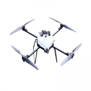
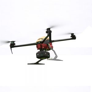
Quadcopter drone 90 minutes endurance
 Accessories, DJI Accessories, Spares and Replacement Parts, Drone motor, Fire Fighting drones, Ground Control Station, Heavy lift Motor/ESC/Propeller, Industrial Drone & UAV parts, LONG ENDURANCE, Multi rotor drone frame, Pay Load for Commercial application, RTK solution, Security and Police Drone/UAV Accessories, Security and Police Drone/UAV frame, Security and police drones, Surveying and Mapping Drones
Quadcopter drone 90 minutes endurance
SKU: 5487FB8/10-163