Crop growth monitoring using Multispectral camera Babyshark VTOL Leave a comment
After the summer, many crops entered the peak season.
At this stage, it is crucial to monitor the spatial distribution, emergence, growth, and pests of crops in the field.
The traditional way of monitoring agricultural conditions is dependent on manpower, time-consuming and labor-intensive, and the observation area is small. At the same time, the accuracy and consistency of the survey are difficult to reach a unified standard, which has certain limitations and is no longer suitable for large-scale farmland. monitor.
How can this problem be better solved?
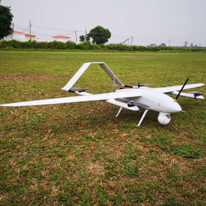
UAV multi-spectral remote sensing system, long operation time, higher efficiency, wide coverage area, high efficiency, flexible maneuverability, easy operation, high spatial resolution data on demand, low application cost, etc. The new application of agricultural remote sensing provides new tools.
The best time period for multispectral data collection is within two hours before and after noon. When collecting spectral data, better weather conditions are required, and the weather conditions need to be kept as constant as possible, so that the accuracy and consistency of the collected data can meet the use demand.
Therefore, in the limited time, in the face of changing weather conditions, a more efficient, more stable, and more accurate radiation correction remote sensing system is needed to obtain accurate agricultural conditions data.
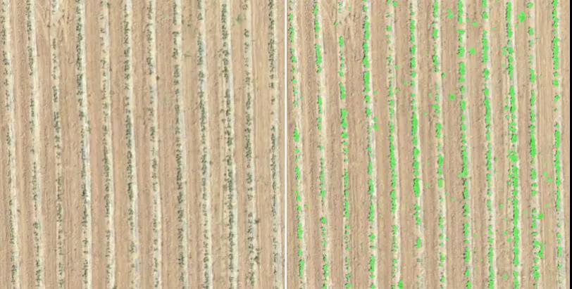
Emergence and seedling growth have an important impact on the growth and development of crops. Rapid, uniform and complete emergence can shorten the time from sowing to full coverage of seedlings, improve the time and space competitiveness of crops, and lay the foundation for establishing the best canopy structure. Improve the quality of the grain to the limit and realize the high yield potential.
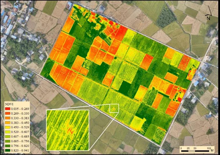
Normalized vegetation index
One of the important parameters that reflects the growth of crops and nutrition information. It has been widely used in regional land cover, vegetation classification and change, primary productivity analysis, crop and pasture yield estimation and drought monitoring.
Leaf area index
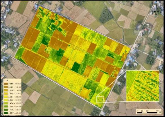
The leaf area index is related to the density, structure, biological characteristics and environmental conditions of the vegetation. It is a comprehensive index that represents the status of vegetation utilization of light energy and canopy structure. It is obtained in the fields of agriculture, fruit industry, forestry, biology, ecology, etc. widely used.
Vegetation chlorophyll map
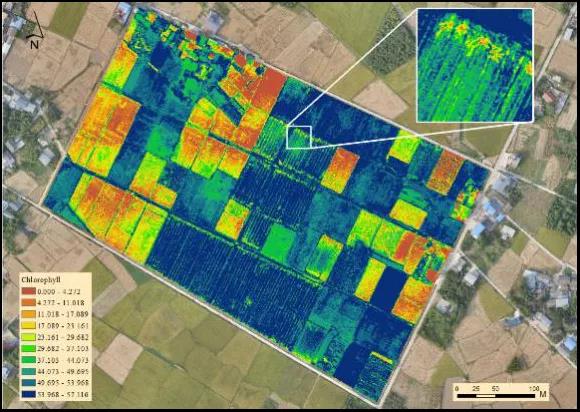
Chlorophyll is the main photosynthetic pigment in plant leaves, and its content is an important indicator for evaluating the physiological status of plants. Using multi-spectral images of UAVs to estimate the content of chlorophyll can quickly determine the health status of plants.
Vegetation nitrogen content map
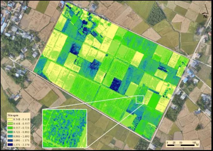
Nutrient elements are the key factors affecting the growth and final yield of crops, and nitrogen is the most important of vegetation nutrients. According to this parameter, it can monitor the nitrogen demand of crops in different seasons, which is important for the rational application of nitrogen fertilizers. Guiding role.
Crop pest information
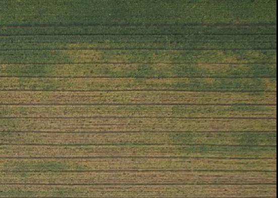
When pests occur in farmland, the plant’s spectral data is extracted and various biochemical parameters of the plant are extracted to obtain plant pest and disease information, so as to further guide the prevention and control of pests and diseases.
Crop lodging
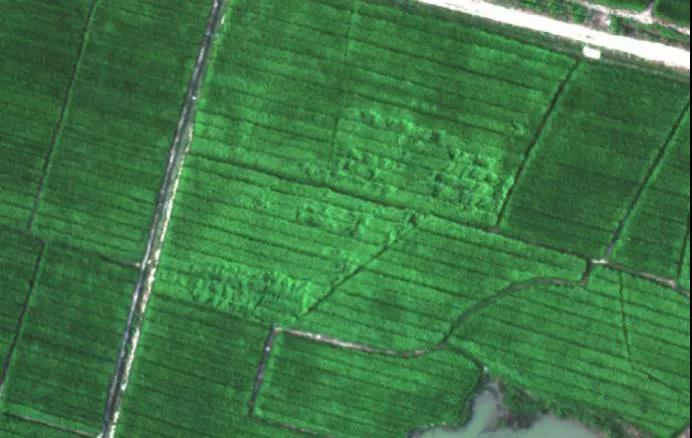
Cropping is the phenomenon of plant stems from natural upright state to permanent dislocation caused by external factors, which is a common problem in crop production. Therefore, timely monitoring of crop lodging is one of the important means to ensure the high and stable yield of regional farmland.